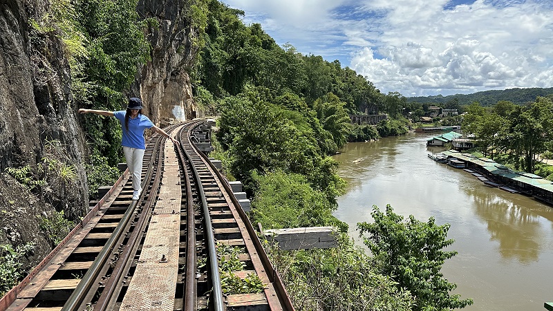
Walking the Death Railway: A Complete Guide
The Death Railway, also known as the Thai-Burma Railway, was a 415-kilometer railway line constructed during World War II by Allied prisoners of war (POWs) and forced laborers under the orders of the Japanese Imperial Army. The railway was built to connect Thailand and Burma, and it was used to transport Japanese troops and supplies to the Burma Front.
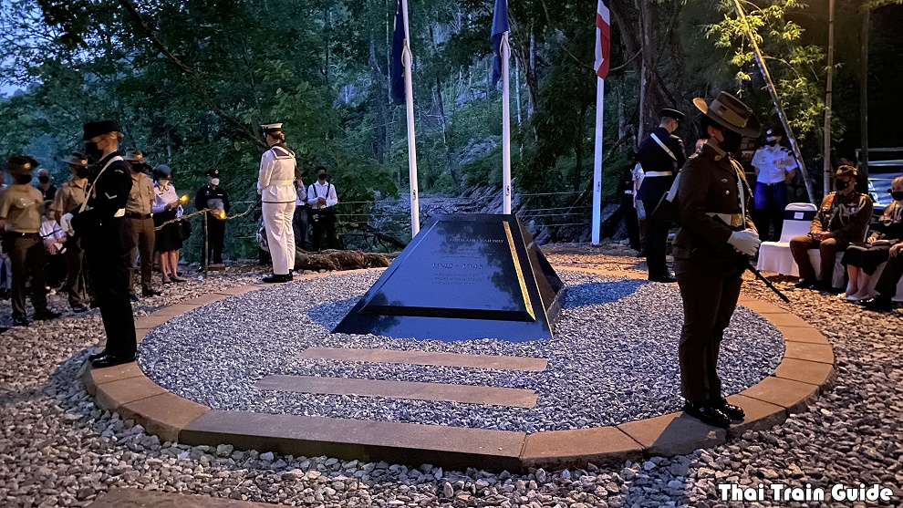
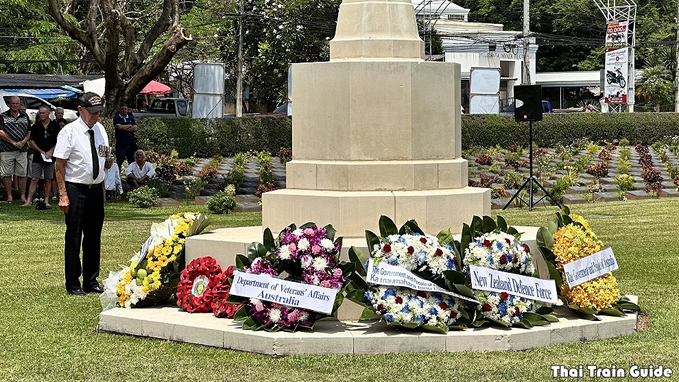
Today, the Death Railway is a popular tourist destination, but it is also a place of remembrance for the POWs and forced laborers who died during its construction. Walking the present-day route of the Death Railway is a challenging but rewarding experience that offers visitors a unique glimpse into the history of this tragic event.
RELATED LINKS: Introduction to the Death Railway
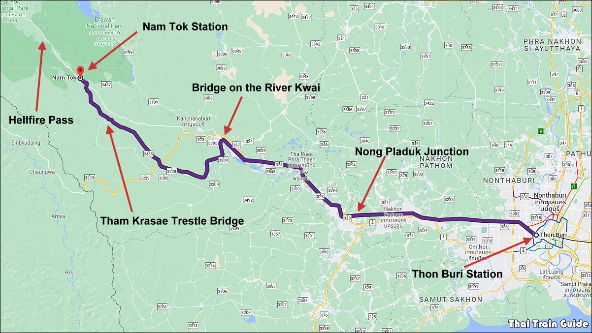
The walk begins at Non Pla Duk Junction, the official starting point of the Death Railway, and ends at the Three Pagodas Pass on the Thai-Burmese border. The present day railway route is 130-kilometre (81 miles) long and only goes as far as Tha Sao, which is now known as Nam Tok Station in Sai Yok. From there, much of the route is hidden in jungles or under a reservoir and so there is no obvious route to the Three Pagodas Pass.
The walk is not only a physical challenge, but it is also an emotional one. As you walk along the railway line, you will pass through some of the most infamous sites of the Death Railway, such as the Bridge over the River Kwai, Chungkai Cutting, Tham Krasae wooden trestle bridge, and Hellfire Pass. At these sites, you will learn about the horrific conditions that the POWs and forced laborers were forced to endure, and you will see firsthand the legacy of this dark chapter in history.
Tracing the Historic Path: Walking the Entire Route of the Death Railway
Walking the Death Railway is a way to pay your respects to the POWs and forced laborers who died during its construction. It is also a way to learn about this important historical event and to raise awareness of the atrocities that were committed. This page has the notes about walking along the line yourself, including a map of the route, the distances, level of difficulty, nearby places of interest, the best time to go and the weather, as well as other tips.
NOTES FOR WALKING THE DEATH RAILWAY – PART 1
These are my notes for walking along the Death Railway from Nong Pladuk Junction to Nam Tok. I am planning on doing this during my next long school holiday. This first section is 131 kilometres long. Though, as I won’t always be able to walk along the tracks due to safety concerns, the walking route will be much longer. The first section from Nong Pladuk to Kanchanaburi, climbs very slowly from 7.15 metres above sea level to 25.36 metres. The next section to Wang Pho climbs to 54.45 metres. Over the next 15 kilometres, it climbs more steadily up to 105.70 metres at Nam Tok which is the present end of the line. For the record, the highest point of the line is beyond this to the west of Tampi at 251.18 metres. This is 147.7 kilometres from the start of the line.
The rules of the challenge is that I will have to visit on foot all of the stations and halts along the route. I can then catch a train to a hotel for the night before taking the train back to the same station where I had finished the day before. I am estimating it will take about five days, though I will add more time to allow me to visit some historic sites along the way. The second section to the Thai-Burmese border is far more challenging and I will need more time for both preparation and the actual walk.
STATIONS ON THE DEATH RAILWAY
There are 29 stations and halts along the present-day Death Railway between Nong Pladuk Junction and Nam Tok Sai Yok Noi. After the war, much of the line had to be rebuilt as it was too badly damaged. The first section between Nong Pladuk Junction to Kanchanaburi re-opened on 24th June 1948. The next section up to Wang Pho, which includes the Tham Krasae wooden trestle, re-opened on 1st April 1952. Then, the final stretch to Nam Tok was re-opened on 1st July 1958. A short stretch to Sai Yok Noi waterfall was later opened for the weekend excursion train. The rest of the line to the Thai-Burmese border was abandoned and very little evidence remains of the exact route.
| STATION/HALT | DEATH RAILWAY (KM) | FROM BKK (KM) | |
|---|---|---|---|
| 1 | Nong Pladuk Junction | 0 | 64.20 |
| 2 | Thanon Songpol | 3.71 | 67.91 |
| 3 | Sa Kosi Narai | 9.46 | 73.66 |
| 4 | Luk Kae | 13.23 | 77.43 |
| 5 | Tha Ruea Noi | 25.58 | 89.78 |
| 6 | Ban Nong Sua | 32.48 | 96.68 |
| 7 | Thung Thong | 38.51 | 102.71 |
| 8 | Pak Phraek | 50.16 | 114.36 |
| 9 | Kanchanaburi | 52.85 | 117.05 |
| 10 | Saphan Khwae Yai | 55.82 | 120.02 |
| 11 | Khao Pun | 57.3 | 121.50 |
| 12 | Wang Lan | 68.5 | 132.70 |
| 13 | Na Kann | 72.26 | 136.46 |
| 14 | Wang Yen | 75.95 | 140.15 |
| 15 | Wang Takhian | 80.6 | 144.80 |
| 16 | Ban Pong Sieo | 83.97 | 148.17 |
| 17 | Ban Kao | 87.75 | 151.95 |
| 18 | Tha Ta Sua | 92.6 | 156.80 |
| 19 | Tha Kilen | 97.75 | 161.95 |
| 20 | Wang Sing | 102.84 | 167.04 |
| 21 | Lumsum | 108.15 | 172.35 |
| 22 | Saphan Tham Krasae | 109.67 | 173.87 |
| 23 | Wang Pho | 113.9 | 178.10 |
| 24 | Ko Maha Mongkol | 119.46 | 183.66 |
| 25 | Chong Khaep | 121.15 | 185.35 |
| 26 | Wang Yai | 124.7 | 188.90 |
| 27 | Ban Pu Pong | 127.05 | 191.25 |
| 28 | Nam Tok | 130.04 | 194.24 |
| 29 | Nam Tok Sai Yok Noi | 131.4 | 195.6 |
DAY ONE: NONG PLADUK JUNCTION TO THA RUEA NOI STATION
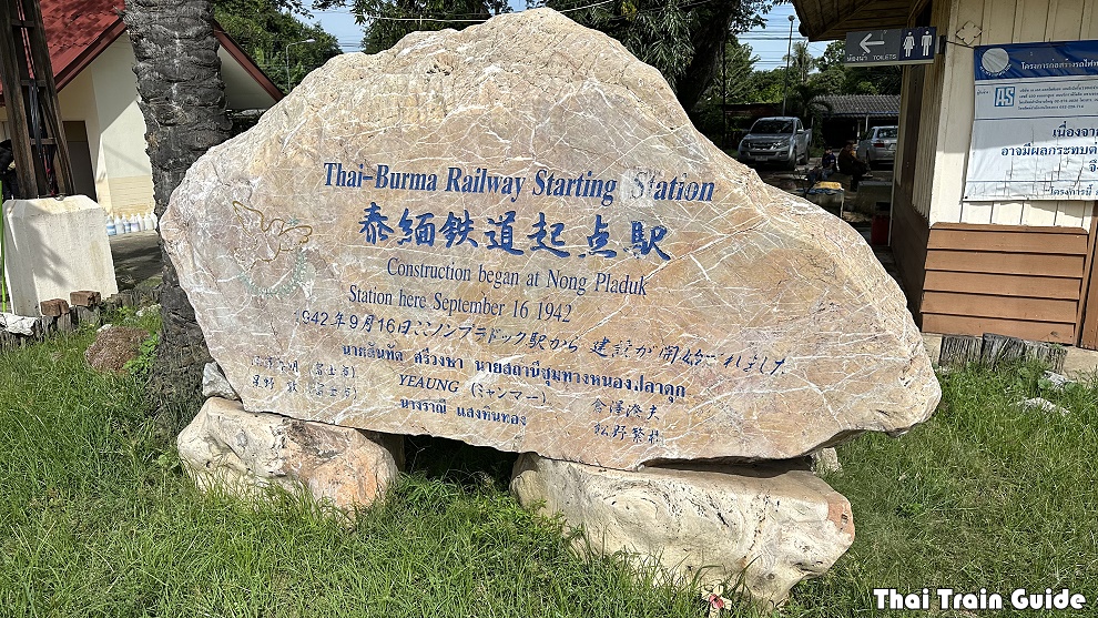
I will catch Ordinary No. 257 train from Thonburi Station in Bangkok at 7:45 a.m. I will take this train to the starting point at Nong Pladuk Junction. Arrival time is 9:21 a.m. This station has a stone memorial marking the official starting point of the Death Railway. The first group of around 2,500 Prisoners of War arrived at Ban Pong by train from Singapore in June 1942. They were responsible for building the work camps at Ban Pong and Nong Pladuk. The next big group, consisting of 9,305 POWs, arrived in October 1942. Some of these POW’s were forced marched from here to Kanchanaburi with an overnight stay in Thau Ruea. The line to Kanchanaburi was completed in November 1942.
RELATED LINKS: Train Schedule for the Death Railway | Map of the Death Railway
I will be visiting Stations 1-5 on the first day. Distance by train to Tha Ruea Noi Station is 25.58 kilometres. By road it will be a bit longer at 27.2 kilometres as I will need to make a few diversions. Tha Ruea is on the banks of the Maeklong River which goes all the way to Kanchanaburi. The infamous bridge crosses this river, though after the movie ‘Bridge on the River Kwai’ was released, the Thai government renamed the stretch of river through town as Khwae Yai. The route to Kanchanaburi is not that scenic or challenging. There are no major hills. The building of this first section was the responsibility of the Thai government. The section from Kanchanaburi onwards was supervised by the Imperial Japanese Army.
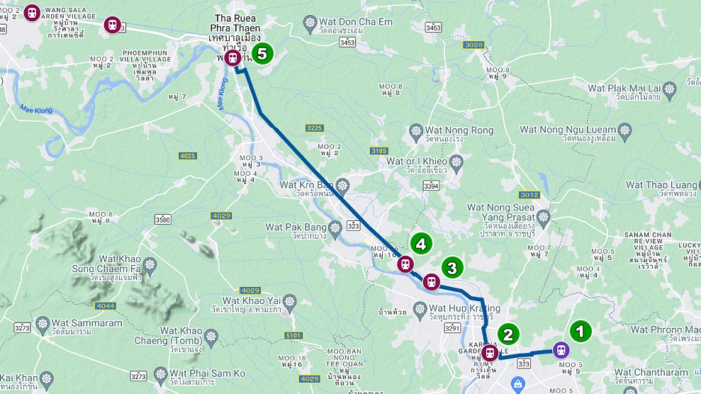
1. Nong Pladuk Junction – 64.20 km (0 km from start)
2. Thanon Songpol – 67.91 km (3.71 km)
3. Sa Kosi Narai – 73.66 km (9.46 km)
4. Luk Kae – 77.43 km (13.23 km)
5. Tha Ruea Noi – 89.78 (25.58 km)
*The official distances for each station are from Bangkok Railway Station. The distance in brackets is for the Death Railway that starts at Nong Pladuk Junction.
I aim to be at Tha Rua Station in time to catch Ordinary No. 259 train at 3:53 p.m. to my accommodation for the first night. I decided it would be a good idea to take this train the entire route to the end at Nam Tok Station. That way I can get a better feel of what is ahead of me. By train it will take two hours and 40 minutes. I should get there at 6:30 p.m. shortly after sunset. I will stay at Yayei Homestay which is a short walk from the station. They only have a few rooms so I will need to book in advance. I plan to leave some clean clothes here as I will stay again at the end of my walk.
DAY TWO: THA RUEA NOI STATION TO SAPHAN KHWAE YAI HALT
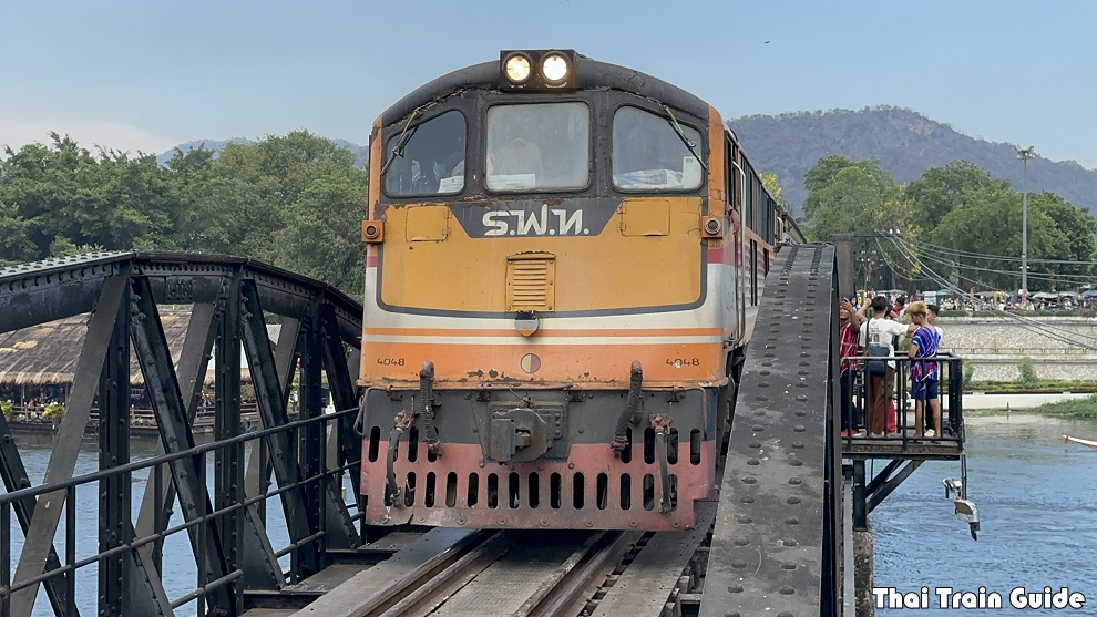
I will catch Ordinary No. 260 train from Nam Tok Station at 5:20 a.m. back to where I finished on Day One. I should arrive at Tha Rue Noi Station at 7:49 a.m. Today I will walk to and visit five more stations, No’s 6-10 on the list. My destination on this day is the ‘River Kwai Bridge’ in Kanchanaburi town. The Thai name for this halt is Saphan Khwae Yai. The walking distance for the second day should be around 33 kilometres.
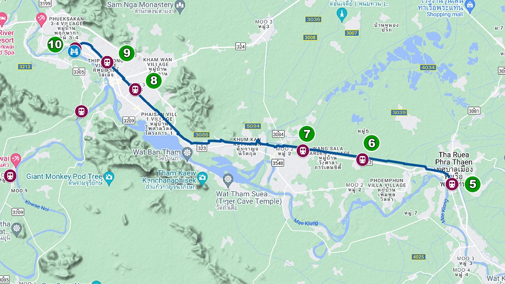
6. Ban Nong Sua – 96.68 km (32.48 km from the start)
7. Thung Thong – 102.71 km (38.51 km)
8. Pak Phraek – 114.36 km (50.16 km)
9. Kanchanaburi – 117.05 km (52.85 km)
10. Saphan Khwae Yai * – 120.02 km (55.82 km)
*This is the River Kwai Bridge Halt
I will spend the night at a hotel within walking distance from the bridge. I am not sure which one yet. The plan would be to spend two nights here so I can wash my clothes and leave some things at the hotel so I don’t have to carry too much on Day Three.
RELATED LINK: Times For Taking Photos of Trains on The Bridge on The River Kwai
DAY THREE: SAPHAN KHWAE YAI HALT TO WANG TAKHIAN HALT
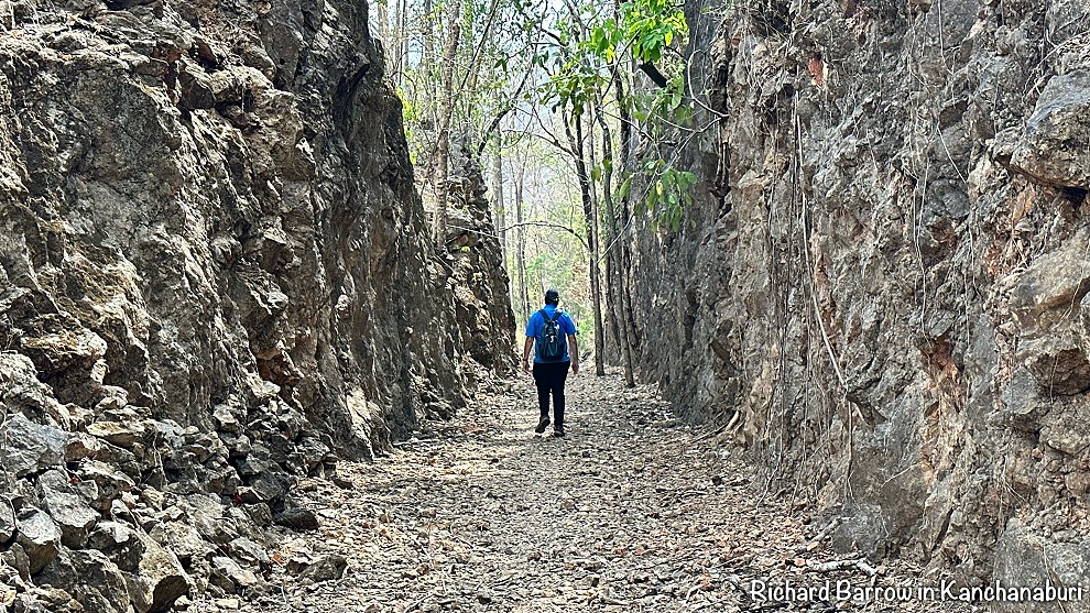
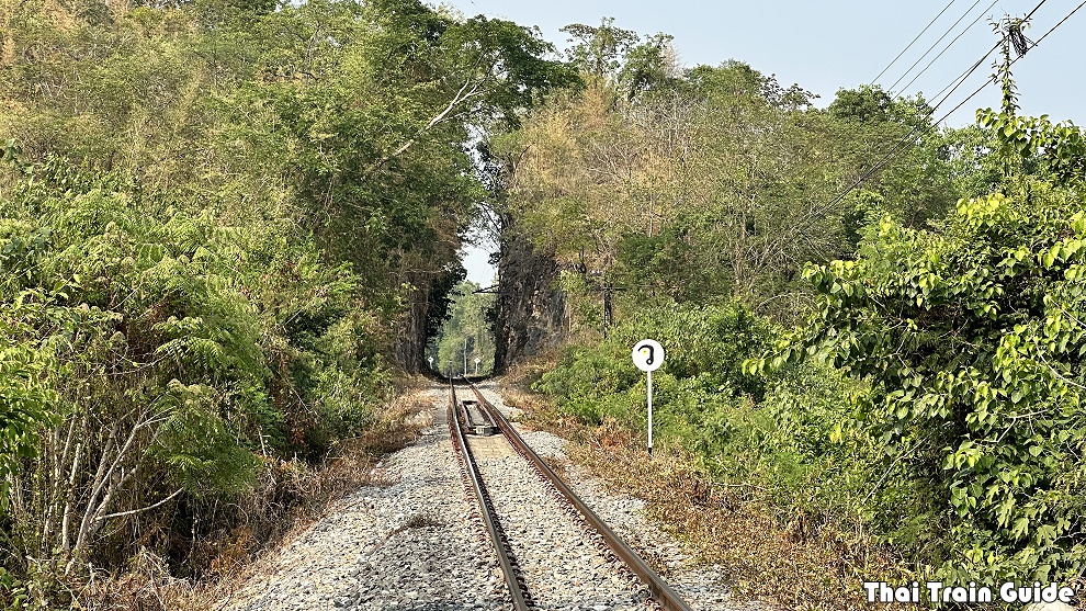
I will walk to another five stations and halts today, No’s 11-15 on the list below, going as far as Wang Takhian Halt. The above photo is of Chungkai Cutting (pronounced “chong-gai”) which is a short distance after Khao Pun Halt at the 125/3 kilometre marker. This is looking back towards Kanchanaburi. The river is to the right. To the left of this picture is a track to a coffee shop which has some nice views. This might be a good spot to take a break.
11. Khao Pun Halt – 121.50 km (57.3 km)
12. Wang Lan Halt – 132.70 km (68.5 km)
13. Na Kann Halt – 136.46km (72.26 km)
14. Wang Yen Station – 140.15 km (75.95 km)
15. Wang Takhian Halt – 144.80 km (80.6 km)
I will aim to catch Ordinary No. 258 train at Wang Takhian Halt at 2:12 p.m. back to the hotel by the bridge. Otherwise it’s Local No. 486 at 4:54 p.m.
DAY FOUR: WANG TAKHIAN HALT TO SAPHAN THAM KRASAE HALT
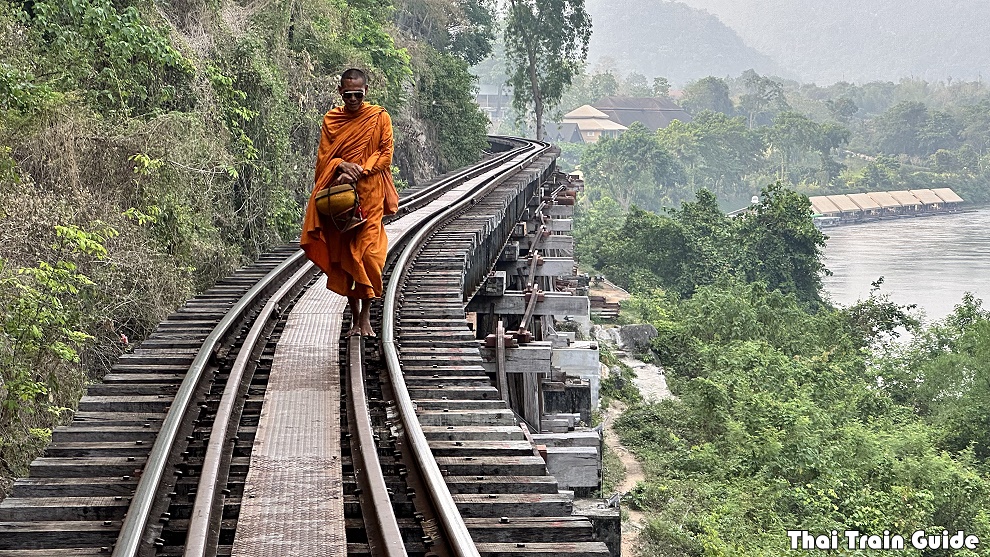
I will catch Local No. 485 train from the bridge at 6:13 a.m. to go back to Wang Takhian Halt where I stopped on Day Three. The plan for today is to walk to seven more stations and halts, No’s 16-22, finishing at Saphan Tham Krasae. This is the wooden trestle bridge that runs along the cliff face above the Khwae Noi River.
16. Ban Pong Sieo – 148.17 km (83.97 km)
17. Ban Kao – 151.95 km (87.75 km)
18. Tha Ta Sua – 156.80 km (92.6 km)
19. Tha Kilen – 161.95 km (97.75 km)
20. Wang Sing – 167.04 km (102.84 km)
21. Lumsum – 172.35 km (108.15 km)
22. Saphan Tham Krasae – 173.87 km (109.67 km)
I will stay one night here by the wooden trestle bridge.
RELATED LINK: Times for Taking Photos of Trains on The Tham Krasae Wooden Trestle Bridge
DAY FIVE: SAPHAN THAM KRASAE HALT TO NAM TOK SAI YOK NOI HALT
This should be the last day of the walk visiting the remaining seven stations and halts, No’s 23-29, all the way to Sai Yok Noi waterfall. As the line goes through areas where there are no roads for much of this route, I might have to do long diversions along roads to reach each station. As the last train back is at 3:30 p.m., I will stay at Yayei Homestay again which is a short walk from the station.
23. Wang Pho – 178.10 km (113.9 km from the start)
24. Ko Maha Mongkol – 183.66 km (119.46 km)
25. Chong Khaep – 185.35 km (121.15 km)
26. Wang Yai – 188.90 km (124.7 km)
27. Ban Pu Pong – 191.25 km (127.05 km)
28. Nam Tok – 194.24 km (130.04 km)
29. Nam Tok Sai Yok Noi – 195.6 km (131.4 km)
DAY SIX: NAM TOK SAI YOK NOI HALT TO THON BURI STATION
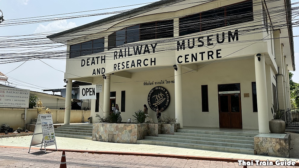
In the morning, I will catch Ordinary No. 260 back to Kanchanaburi. I will have breakfast near the station and then visit the nearby museum and war cemetery to reflect on my long walk. I will then catch Ordinary No. 258 back to Thonburi at 2:45 p.m.
Feel free to add comments and suggestions in the replies below. Thanks.
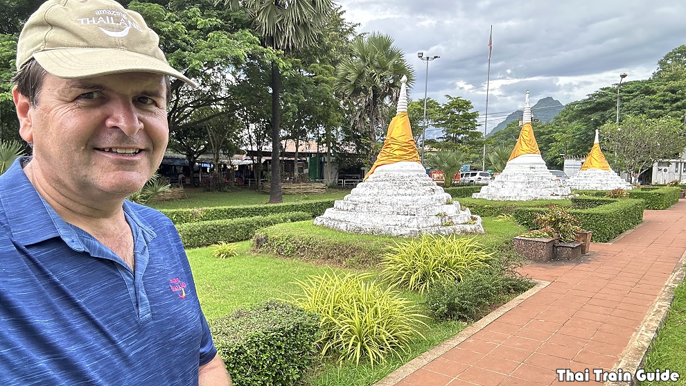
This is the end of the first part of my walk along the Death Railway. I will come back another time to walk the next part to Three Pagoda Pass. I reckon the second part will take 2-3 weeks. I will post my notes here later.
RETURN TO: A Complete Guide to the Death Railway


Hi Richard. We met at the Tham Krasae halt the other day when the Royal Blossom train was coming though.
I’ve just now passed through Nong Pladuk and the platform extension works that have been going on for some time have now reached the commemorative rock. They’re working right around and up close to it, making it look at risk of damage. It also looks like the platform extension will obscure the rock, if it remains where it is is now. I hope the rock remains undamaged and has a place of prominence when the work is complete.
Oh, that is a worry. I will ask the station master the next time that I am there.
Hi
My dad was a Pow ,Burma railway for 3 1/2 years ,missing in action feared dead for 18 months. Dad as I believe was sent further up the line and I am unsure how accessible the other camps en route North after Nam Tok are . Would love to retrace some of his and his mates footsteps.
Gday Richard,
Do you know if any non-Burmese, i.e. Caucasian or European or “white” people/organisations, have ever done a complete visit/retracing of the Burmese side of the WW2 Railway, all the way to or from Thanbyuzayat, since the Recovery & Burial Parties soon after the war finished?
I know of a small group of Europeans + one Australian who did it in 2019, and they claim to be the first who have done it since those post-war Burial Parties?
Could that possibly be true, you think?
My father in law was a POW here and helped to build the railway.
He had nightmares and just told us a few terrible stories of what happened.
My Son, his Grandson, is going there at the moment to pay respects to his Grandfather, and am so proud of him doing this xx 💞
Wonderful information.
Question: Taking the early 6:10 a.m. train from Kanchanaburi to Nam Tok, can you purchase a ticket at the Sapan Khwae Yai “halt” and get on there or do you have to go to the main Kanchanburi “station” to purchase the ticket and get on there? I can’t seem to find an answer to my question on any website.
There’s no ticket office and so you are allowed to buy on the train.
I’m too old to attempt this, so will stick to paying my respects in the more traditional way (by train). I’m sure there will be many young Australians (together with POW descendents from many other countries) who will follow your route. Good luck!
Thanks Patrick. I’ve done the train ride many times, but you don’t really get a feeling of distances or even how much work was needed to build the railway. You get too comfortable on the train to stop to think about the hardship the POW’s and Asian labourers suffered. Even in a 3rd Class carriage. Even though I will be walking the length of the route, I will only feel a fraction of their hardship as I will have the benefit of good shoes and knowing I will be staying in a bed each night.
Good luck Richard. Just beyond Wang Pho there are 4 long, high or both, viaducts which are quite scary to cross. At the first bridge after Chungkai Cutting you will get a taste of what is yet to come, but the 4 after Wang Pho are a whole different thing. If you email me I can send you some video of my experience there.